Big Sur coastline
April 26, 2026 @ 6:45 AM
big sur int'l marathon
Marathon Iconic Difficulty ★★★★★

2,182 feet of climbing along the most spectacular highway in America, a concert pianist on a bridge 260 feet above the Pacific, and the loneliest stretch of any marathon in the country.

PaceKit By PaceKit Team · Updated April 2026 · Built from course data, historical conditions, and runner reports
Course Difficulty
5/5
84 ft of climbing per mile, 16 miles of wind exposure, and the hardest terrain hits after the halfway point.
Climbing
Steepness
Exposure
Placement
What You Need to Know
  1. THE REDWOODS ARE A TRAP 225 ft of downhill in the first 3 miles, under cool canopy, at 6:45am. It feels like nothing. That's the problem.
  2. THE HARD PART ISN'T HURRICANE POINT It's the 7 miles after it. Rolling hills, 8% shade, persistent NW headwind, zero spectators.
  3. 2,182 FT OF CLIMBING ON HWY 1 Difficulty 5/5. Not a BQ course. Not even close.
  4. HURRICANE POINT IS NAMED FOR A REASON Crosswinds clocked above 100 mph on this headland. Budget 30-45 seconds per mile here.
  5. A MAN IN A TUXEDO PLAYS A GRAND PIANO ON THE BRIDGE Mile 13. 260 feet above the ocean. He's been doing it since 1987.
Elevation Profile
Redwoods Hurricane Point Bixby Bridge The Wall D-Minor Hill
the brief

This breakdown is based on detailed course mapping, historical race conditions, and real runner feedback from past years.

You signed up for this because something about it felt different. Not a PR attempt, not a BQ qualifier (it isn't one), not even a race in the traditional sense. Big Sur is the closest thing running has to a pilgrimage. Highway 1 is closed to traffic, 2,182 feet of elevation stands between you and Carmel, and somewhere around mile 13, a pianist in a tuxedo will be seated at a Yamaha grand on a bridge 260 feet above the Pacific. That is why you are here. And that is exactly what you are going to get.

The course runs point-to-point from the redwoods south of Big Sur Village into Carmel-by-the-Sea, and it changes completely every few miles. The first three are under 800-year-old redwood canopy, shaded, cold, quiet, gently downhill. The trees vanish at mile 5 and the Pacific opens in front of you. You run exposed coastline with the Point Sur Lighthouse visible in the distance (volcanic rock, 361 feet above the surf, active since 1889), before the road tilts sharply upward at mile 9.85. Hurricane Point is 513 feet of gain over 2.15 miles, steeper and longer than Heartbreak Hill. After the descent, you cross Bixby Bridge, 714 feet long, 260 feet above the canyon floor, built in 1932, the most photographed bridge in California. Then it gets genuinely hard.

A few things worth knowing before April 26. The start area runs cold, low 40s at 6:45am, and runners have reported long corral waits before the gun. Bring a throwaway layer. The course has essentially no spectator access between miles 3 and 21 (Highway 1 is closed), which means no crowd noise, no outside energy, no check-ins. What you bring mentally is what you run with. The pacing is counterintuitive: the first three miles deserve your most disciplined running of the day, Hurricane Point deserves patience rather than bravado, and miles 17 through 21, open ranch country, NW headwind, nobody around, are where races come apart for people who ran the first half wrong.

Your Priorities
01
Add 5 seconds per mile through the redwoods. Cold air, predawn forest, 225 feet of gentle downhill, no spectators. The conditions quietly push you faster than you should go. The hills after mile 14 are relentless, and every second you save now is worth considerably more later.
02
Hurricane Point is not the race. The seven miles after it are. Most runners fixate on the climb, 513 feet, 2.15 miles, exposed headland. It deserves respect. But from mile 14 to mile 21, you are running through seven climbs, five descents, 8% average shade, and a persistent NW headwind with no spectators and nothing to distract you. That is where the race is decided.
03
Hit the mile 7.8 aid station and treat it seriously. There is a 3-mile gap to the next one at 10.4, which sits at the base of Hurricane Point. You want to go into that climb fully stocked. This is the one logistical detail that most pre-race guides skip and most runners wish they'd known.

segment breakdown

By terrain, exposure, and how effort changes across the race.

the redwoods Miles 0-3
65% shade Sheltered wind -225 ft elev
Coastal redwoods

The gun goes at 6:45am. You are in the dark, or close to it, under coastal redwoods in Pfeiffer Big Sur State Park. Some of these trees were saplings in the 13th century. The air is in the low 40s. The crowd noise from the start area falls away almost immediately once you are under the canopy. No cell service. No spectators. Just the sound of several thousand runners and the Big Sur River somewhere off to the side.

The first 0.31 miles drop 83 feet at -5.1% grade. It levels, but the net through mile 3 is still downhill, 225 feet of net descent over the opening stretch, 65% shade, and NW wind completely blocked by the trees. The official course guide calls this section "fast and furious." Runners say "it was easy to just let the legs go." That is the trap. The course is 800-year-old trees watching you go out too fast, and they have seen it before.

Add 5 seconds per mile in here. Every time.

Aid stations: Mile 2.5 (Big Sur Village: water, electrolyte, porta-potty, medical)

big sur valley Miles 3-5
30% shade Partial wind Rolling elev
Big Sur Valley

The redwoods thin around mile 3. By mile 4 you are in open meadow, Andrew Molera State Park to your right, 4,800 acres, largest on the Big Sur coast. The Pacific makes its first appearance, glinting at the horizon.

Shade drops from 65% to 30% as the canopy gives way to scattered oaks. The NW wind, blocked for the past three miles, arrives from your left-front, 15 to 25 mph, persistent through almost the entire coast section. The hills here are gentle and rolling. If you ran the redwoods right, you feel good. If you went out hot, you do not know it yet.

Aid stations: Mile 4.8 (Andrew Molera: water, electrolyte, porta-potty, medical)

the coastal approach Miles 5-10
5% shade NW Exposed wind -180 ft elev
Point Sur Lighthouse

At mile 5, the race reveals its character. No trees, no protection, nothing between you and the ocean except a guardrail and a shoulder. Point Sur Lighthouse appears in the distance, 361 feet of volcanic rock, in continuous operation since 1889. The runners around you have spread out by now. The noise is gone.

These miles are described by runners as "pastoral," and that's accurate for most of them. "Hills awash with vibrant, colorful wildflowers," one runner's description, not a tourism brochure. Cattle on the hillsides watch your splits. Point Sur Hill at mile 8.32 is the first genuine wake-up call: 79 feet of gain over 0.41 miles at 3.68% grade. Sharp. Brief. A preview. The road then drops 174 feet into the pre-Hurricane valley, and in the distance, the headland rises.

One critical note: the aid station at mile 7.8 is the last fully-stocked stop before Hurricane Point. After it, there is a 3-mile gap to mile 10.4, which has water and electrolyte only. Take what you need at 7.8. This detail matters more than it sounds.

5% shade. Persistent NW headwind from the left-front.

Note

There's a 3-mile gap between the mile 7.8 and mile 10.4 aid stations. This is the longest unsupported stretch before the biggest climb on the course. Plan for it.

Aid stations: Mile 7.8 (Point Sur Climb: water, electrolyte, porta-potty, medical)

hurricane point Miles 10-12.2
5% shade 100+ mph wind +513 ft elev
Hurricane Point

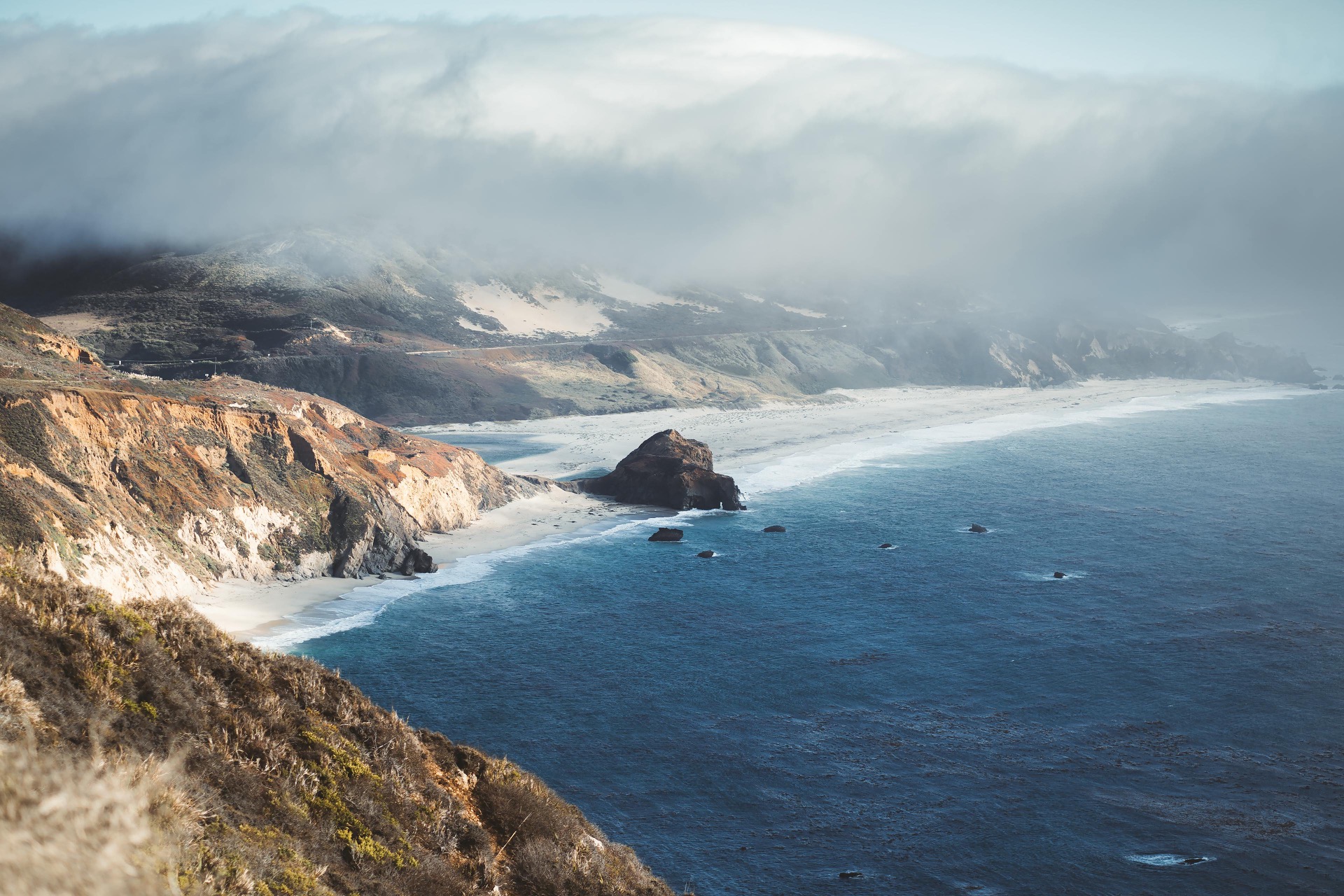
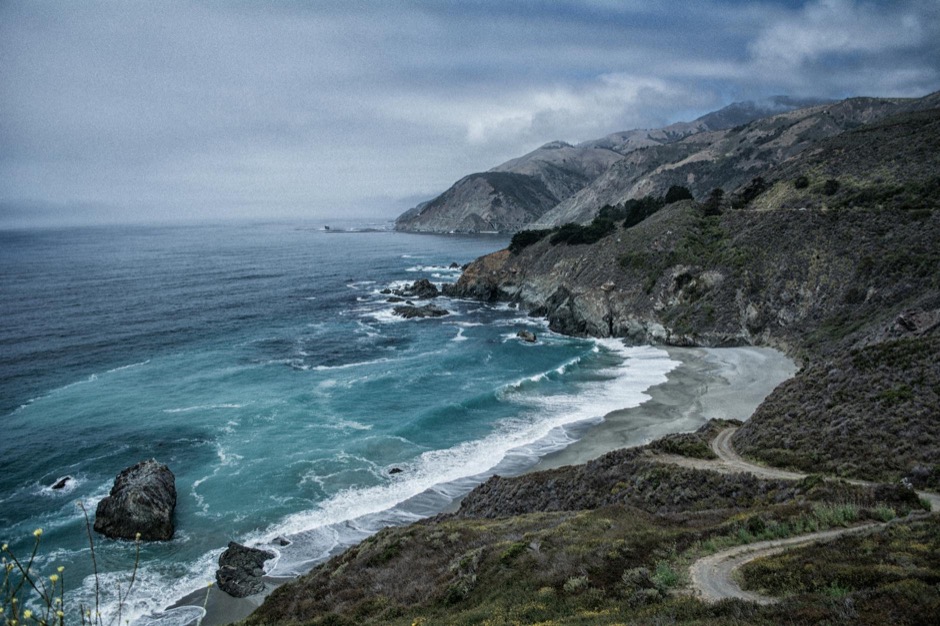
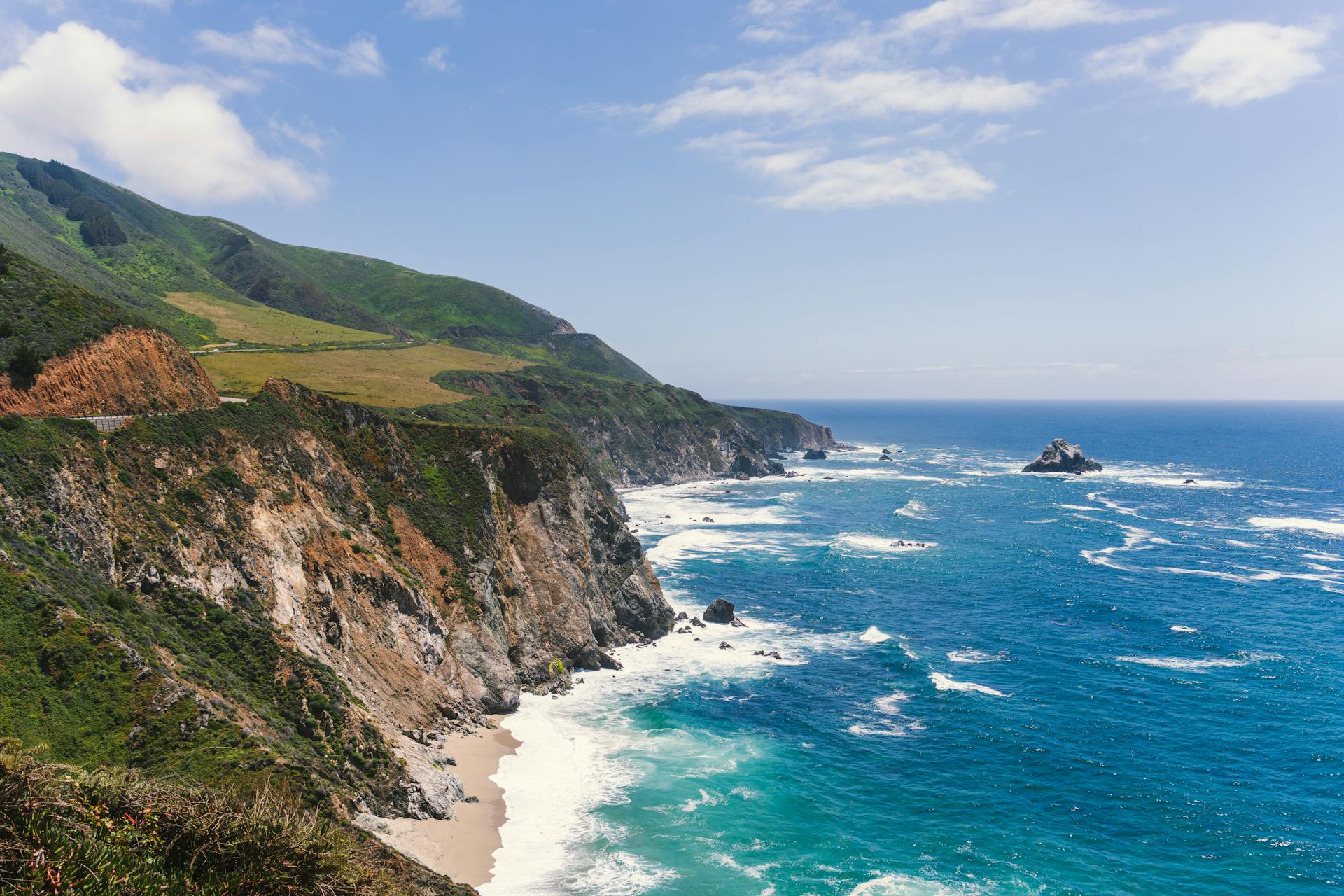
513 feet of gain over 2.15 miles. Average grade 4.52%. Steeper and longer than Heartbreak Hill at Boston, which averages 3.5%. The difference is that you are also running into wind that has been clocked above 100 mph on this exact piece of land.

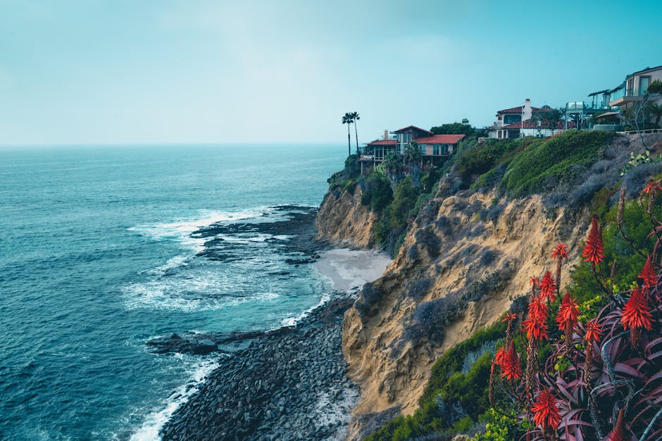
Hurricane Point is a headland, land jutting into the Pacific at 570 feet. The prevailing NW coastal wind compresses as it wraps around the point. NOAA identifies Point Sur as a major wind acceleration headland. Speeds here can hit 2-3x the wind speed of nearby areas. The combination of elevation, full exposure on three sides, and bare ocean wind hitting bare cliff face with nothing to slow it produces conditions unlike anything else on the course.

"My arms became numb from the windchill. The sound of the wind was deafening."

"The combination of steep climb plus 50mph gusts made it feel like we were running in place at times."

Heads up

Runners consistently report numb hands and arms on this stretch, even on days with moderate air temperatures. Light gloves and sleeves earn their weight here.

Run by effort. Don't look at your watch. Expect to lose 30-45 seconds per mile. This is priced into the plan.

Here is something no one is prepared for: there are Taiko drummers at the base of the climb, at mile 11. Every year, volunteer drummers perform synchronized Japanese percussion at the foot of the hardest section of the course. You hear them before you see them. They are thunderously loud and widely considered the best moment of spectator support on the entire route. Just get to the drums.

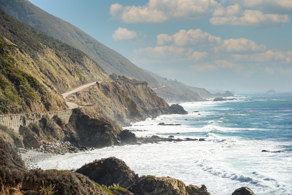
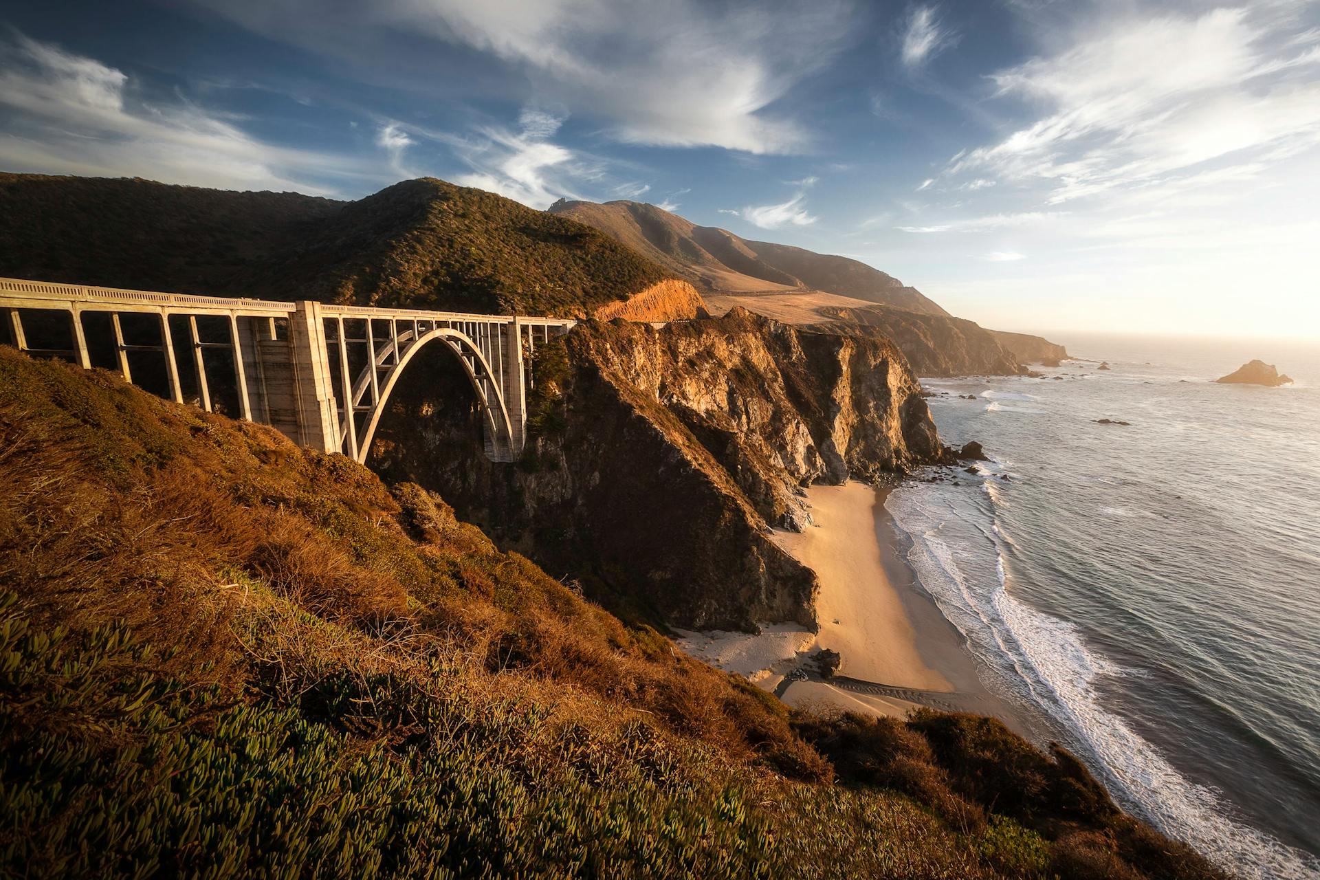
Gel station at the summit (mile 12.2). Take it. Then the road drops 298 feet in a single mile at -5.5% grade. "As soon as we rounded the point, the wind started to drop miraculously." Almost everyone says a version of this.

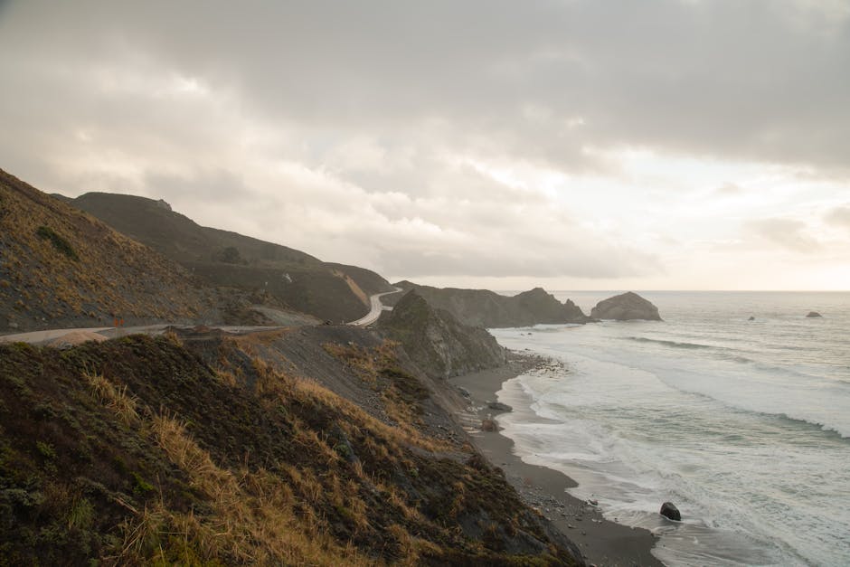
Aid stations: Mile 10.4 (Hurricane Point Base: water, electrolyte), Mile 12.2 (Summit: water, electrolyte, GU Gel)

bixby bridge Miles 12.2-14
5% shade Exposed wind -298 ft elev
Bixby Creek Bridge

You descend 298 feet from the summit and, around mile 13.0, the bridge appears.

714 feet long. 260 feet above the canyon floor. Built in 1932 using locally-sourced concrete and open-spandrel arch construction that was, at the time, among the longest of its kind in the world. It is the most photographed bridge in California. When Apple needed a default wallpaper for one of its major operating systems, one image, out of anywhere on the planet, they chose this spot.

At mile 13, a man in a tuxedo is seated at a Yamaha grand piano on the bridge deck. He has been doing this since 1987. The concert pianist plays while thousands of runners cross 260 feet above the ocean. Runners call it "the most rewarding vista of the race" and it arrives at the halfway point, exactly when you need something.

Cross it. Look at the ocean. This is why you are here.

Aid stations: Mile 14.7 (Rocky Creek: water, electrolyte)

the rolling coastline Miles 14-17
10% shade NW wind Rolling elev
Rocky Creek Bridge

This is where it starts. Not dramatically. Just steadily, then all at once.

Miles 14 through 17 contain seven climbs and five descents. The biggest is the Rocky Creek Roller at mile 15.18: 92 feet over 0.41 miles at 4.21% grade. None of them are Hurricane Point. All of them cost something. 10% average shade. NW wind still arriving from the left. No spectators since mile 3.

"Hills after Bixby were much harder than I would have thought." This is the most common phrase in Big Sur race reports, and it appears because Bixby feels like an arrival. It is not an arrival. It is a checkpoint. The race continues. Runners who went out conservatively feel this section. Runners who didn't feel it considerably more.

Run 5 seconds per mile faster on the descents if you have it. Don't pound them, your quads are going to be asked for more later.

Aid stations: Mile 14.7 (Rocky Creek: water, electrolyte), Mile 16.9 (Palo Colorado Canyon: water, electrolyte)

the isolation Miles 17-21.2
8% shade NW Direct wind Rolling elev
Empty Highway 1

This is the section the course is named for when runners call it "the loneliest marathon in the US." Highway 1 is closed. No spectators between miles 3 and 21. Just open ranch country, cattle on the hillsides above you, and a NW headwind that has now shifted to a more direct head position. The nature that once caught the pre-dawn light now coldly watches you work through miles 19 and 20.

Run 10 seconds per mile slower than goal pace through here. Not because you want to. Because you will anyway. The question is whether you make the choice or the course makes it for you.

The Wall appears at mile 20. A towering dirt embankment on the side of the road. Purely psychological, and that is exactly what makes it work. The Garrapata Climb at mile 19.57, 49 feet at 4.46% grade, is small on paper and significant in reality. "My legs felt completely trashed... I sank into a rhythm that felt sustainable." Find that rhythm. It is available. It just requires having saved something to find it with.

One GU Gel station at mile 19.0. Take it.

Aid stations: Mile 19.0 (Coastal Station: water, electrolyte, GU Gel, fruit), Mile 21.2 (South Carmel Highlands: water, electrolyte, fruit)

carmel highlands Miles 21.2-24
25% shade Partial wind Rolling elev
Carmel Highlands

The crowd returns at mile 21. After 18 miles of silence, this is significant in a way that is hard to explain until you experience it. Residents of Carmel Highlands line the road. At mile 23.2, Strawberry Station appears: fresh local strawberries, live music, real human beings who are genuinely happy to see you. It hits harder than it should, and it should hit very hard.

One thing to know before it: the Carmel Highlands Kicker at mile 22.02 is the steepest uphill grade on the entire course. 60 feet at 5.59% grade over 0.21 miles. At mile 22, after everything, this is unpleasant. You now know to expect it. After mile 22.23, the road drops 117 feet at -5.39% grade. Go.

At mile 24, there are belly dancers. Just so you know.

Aid stations: Mile 21.2, Mile 23.0 (Highlands Inn: water, electrolyte, fruit), Mile 23.2 (Strawberry Station: fresh strawberries), Mile 24.5 (Point Lobos Approach: water, electrolyte, fruit)

point lobos to carmel Miles 24-26.2
35% shade Sheltered wind +87/-85 ft elev
Point Lobos

D-Minor Hill. Mile 24.98 to 25.29. 84 feet at 5.12% grade. Named, according to course lore, for its ability to bring you down.

"D-Minor Hill at D-Major Time."

It is the last real obstacle. After it, Monterey pines and eucalyptus provide the most shade since the redwoods, 24 miles ago. The wind drops, Carmel Bay headlands shelter the final stretch. Point Lobos State Reserve, the crown jewel of the California state park system since 1933, is to the right. The Carmel River Beach lagoon appears in the final half mile.

Then: the finish.

If you ran this correctly, conservative through the redwoods, disciplined through Hurricane Point, patient through the isolation, the final 2 miles feel different from what they could have been. Not easy. Different.

Aid stations: Mile 24.5 (Point Lobos Approach: water, electrolyte, fruit)

try pacekit

A course guide can only take you so far. What you actually need on April 26 is someone in your ear who knows what's coming, who caught that you went out 8 seconds per mile too fast in the redwoods, and who can tell you exactly what to do when you hit the base of Hurricane Point.

That's what we do. It's completely free.

This isn't a generic plan. It's built around this course.

Check it out

Free · iPhone + Apple Watch

Answered by Us (8 answers)

Is Big Sur hard?
Difficulty rating and climbing load
Elevation profile breakdown
2,182 ft of climbing, section by section
Hurricane Point breakdown
Wind science and how to run it
Weather in April
40s to upper 50s, plus wind
Pacing strategy
Mile-by-mile from course data
Is Big Sur a BQ course?
Technically yes, practically no
The Bixby Bridge pianist
Since 1987, 260 feet above the ocean
What to wear
Dress for 55 with wind

final notes

This race changes the whole way through. You start in the dark under the trees, you finish in the sun in Carmel, and everything in between depends on how you handle the middle.

The climb gets the attention, but it's not the whole story. What happens before it, and especially after it, matters more. Once you're out on the coast, it's just you, the road, and whatever you brought with you that day.

Keep it controlled early, stay patient longer than you want to, and don't try to force anything. If you do that, the last few miles feel a lot different.

And at some point, look up. You're running along one of the best stretches of coastline in the world. It's easy to miss it if you're locked in the whole time.

run it with someone who knows the course

You don't need to remember all of this on race day. We give you a voice in your ear that knows what's coming, when to ease off, when to push, and how to adjust as the race unfolds.

Raul's a good fit here. Calm delivery, drops local history and course intel at the right moments, and makes hard miles sound manageable. The kind of voice you want at mile 19 on an empty highway with no one around.

This isn't a generic plan. It's built around this course.

Check it out

Free · iPhone + Apple Watch