Mountains to Beach
April 19, 2026 @ 6:10 AM
mountains 2 beach marathon
Marathon Point-to-Point Difficulty ★★☆☆☆

A 1,400-foot descent from the mountains above Ojai to the Pacific Ocean, through citrus groves, the Ventura River, and a beachfront finish on one of the better stretches of Southern California coastline.

PaceKit By PaceKit Team · Updated April 2026 · Built from course data, historical conditions, and runner reports
Course Difficulty
2/5
Net downhill point-to-point. 929 ft net descent, 322 ft total ascent. The difficulty is in managing the descent, not climbing.
Climbing
Steepness
Exposure
Placement
What You Need to Know
  1. THIS IS A NET DOWNHILL COURSE. THAT'S THE TRAP. 929 feet of net descent sounds like free miles. Quads don't work that way. The steepest section hits -6% to -9% at mile 15. What you do there determines what you have at mile 22.
  2. THE ONLY REAL CLIMB IS AT MILE 3.5 146 feet at 0.9% average grade through the Ojai foothills. It arrives early and feels manageable. Add 25 seconds per mile and treat it like it matters.
  3. MILES 13-16 ARE THE MOST TECHNICALLY DEMANDING The Ventura River corridor drops sharply through Foster Park. Large California sycamores, winding road, steep grades. This is where the race is won or lost.
  4. THE PROMENADE HITS AT MILE 19 Pacific Ocean to your left, crowd support, beachfront running. After miles of open valley road, this arrives at exactly the right time.
  5. 6:10 AM START IN OJAI Cool mountain air, pre-dawn dark, 950 feet above sea level. The Ojai Valley is sheltered from coastal wind. Enjoy it while it lasts. :)
Elevation Profile
Ojai Meiners Oaks Foster Park Promenade Beach
the brief

This breakdown is based on detailed course mapping, historical race conditions, and real runner feedback from past years.

Mountains 2 Beach is a point-to-point from downtown Ojai to the Pacific Ocean, and the name is not metaphorical. You start in a mountain town at 950 feet before sunrise, run through the Ojai Valley on an old railroad trail, drop through the Ventura River gorge past giant sycamores and citrus groves, and finish on a wide sandy beach with the Pacific in front of you. The scenery rating is 5/5 because that description is accurate.

The course runs east through downtown Ojai, climbs into the foothills above Mira Monte, crests near mile 6, and then descends through Meiners Oaks onto the Ojai Valley Trail. From there it follows the old Southern Pacific Railroad right-of-way through open ranch land and horse properties into the Ventura River corridor, drops steeply through Foster Park, transitions onto Ventura Avenue into the city, and hits the beachfront Promenade at mile 19. The net descent is 929 feet over 26.2 miles. Total ascent is 322 feet. On paper, this is a fast course. In practice, it depends entirely on how you handle 1,252 feet of cumulative downhill.

A few things worth knowing before April 19. The 6:10am start means Ojai in the dark, which is cooler and calmer than the exposed miles ahead. Shade drops from 35% in Meiners Oaks to 10% on Ventura Avenue and the Promenade. If April is warm, the back half of this course runs hot. The Ventura River corridor at miles 13 through 16 is the most technically demanding section: -6% to -9% grades, winding road, and the exact stretch where quad-destroying downhill running sets up a painful final 10 miles. The runners who finish this course well are almost always the ones who treated that descent with more patience than it seemed to require.

Your Priorities
01
Respect the climb at mile 3.5 more than feels necessary. It's 146 feet, modest grades, and arrives when your legs are fresh and the cool Ojai air makes everything feel easier than it is. Add 25 seconds per mile and run purely by effort. The descent to Meiners Oaks is immediately on the other side, and arriving there relaxed sets up the next 7 miles.
02
Do not run the Foster Park descent fast. Miles 13 through 16 drop sharply through the Ventura River corridor at grades hitting -9%. It will feel like the course giving you something. It is not giving you something. Add 10 seconds per mile over goal pace, shorten your stride, stay controlled, and arrive at Ventura Avenue with functioning quads. The final 10 miles on this course depend on this decision more than any other.
03
The Promenade is the reward, not the finish. Mile 19 brings the Pacific, the crowd, and a surge of energy that will tempt you to open up hard. There are still 7 miles to run. Settle into 5 seconds per mile faster than goal pace from mile 17 onward and let the progression build naturally. The final 5K from downtown Ventura to the beach should be the fastest miles of your day, but only if you haven't already spent everything on the Promenade.

segment breakdown

By terrain, exposure, and how effort changes across the race.

the ojai loop Miles 0-3
20% shadeSheltered windRolling
The Ojai Loop

The race starts at 6:10am in downtown Ojai, near the Spanish-revival Post Office Bell Tower, a defining landmark of a town that has looked mostly the same since the 1920s arcade was built along East Ojai Avenue. The air is cool and the valley is sheltered. The Topa Topa Mountains block coastal wind entirely at this elevation. It is a genuinely pleasant place to start a marathon.

The opening mile climbs slightly to just under 1,000 feet before dropping back. It feels like nothing. That's accurate, for now. The course moves east through downtown, the crowd moderate, the streets quiet at this hour. Add 12 seconds per mile and let the legs settle. The real climb begins at mile 3.5.

Aid stations: roughly every 1.5-2 miles throughout

the climb Miles 3-6.2
15% shadeSheltered wind+146 ft
The Climb

The course winds through Mira Monte and the East Ojai foothills and the road tilts upward. This is the hardest climbing section on the course, 146 feet over a sustained stretch with grades averaging 0.9% but pitching higher at points. The terrain is largely exposed, 15% shade, and the valley opens below you as you gain elevation.

Switch to effort-based running. Add 25 seconds per mile over goal pace and don't negotiate with that. The course crests near mile 6 at just over 1,000 feet and the Meiners Oaks descent is immediately on the other side. This climb is manageable if you respect it and unpleasant if you race it.

meiners oaks Miles 6.2-9
35% shadeLight wind-100 ft
Meiners Oaks

After the crest, the course drops through Meiners Oaks, a small unincorporated community of ranch-style homes and oak-dotted lots west of Ojai, and transitions onto the Ojai Valley Trail. The old Southern Pacific Railroad right-of-way, now a paved multi-use path, carries you through 35% canopy at a consistent and gentle -1.5% to -2.0% grade.

This is the best shade on the course. Let the descent help, but not completely. Run 5 seconds per mile faster than goal pace on the gentle grade, not 30. The instinct to open up here is the first mistake most runners make on this course. The Ojai Valley stretches ahead, open and exposed, and the easy miles need to be treated as a gift to be managed, not spent.

the valley Miles 9-13
20% shadeWSW wind-80 ft
The Valley

Santa Ana Boulevard through open ranch land and horse properties. The railroad trail gives way to quiet country road, the canopy drops to 20%, and the terrain flattens to gentle rolling downhill. This is the most monotonous stretch on the course and it arrives in the middle of the race where monotony does the most damage.

Lock into goal pace and stay there. The wind begins arriving from the west as the valley opens toward the coast. Partial exposure through here, increasing as you approach the Ventura River corridor. The San Antonio Creek footbridge appears around mile 14, a wooden arched crossing that marks the transition into the steeper section of the descent. After the bridge, the road starts dropping in earnest.

Take whatever fuel is available at the aid stations through here. The Foster Park descent is ahead.

the big drop Miles 13-16
30% shadeWSW headwind-200 ft
The Big Drop

This is the most technically demanding section of the course.

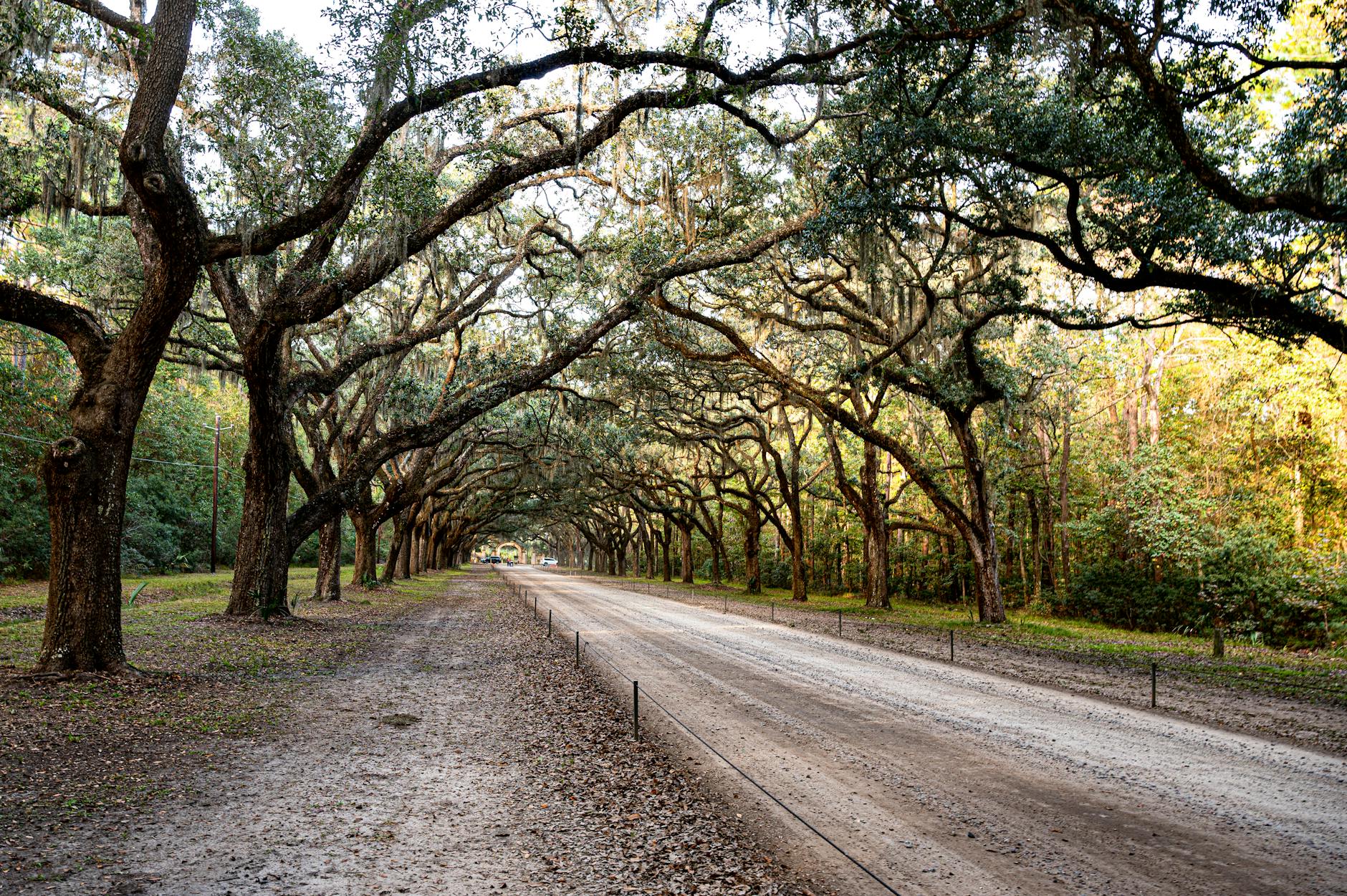
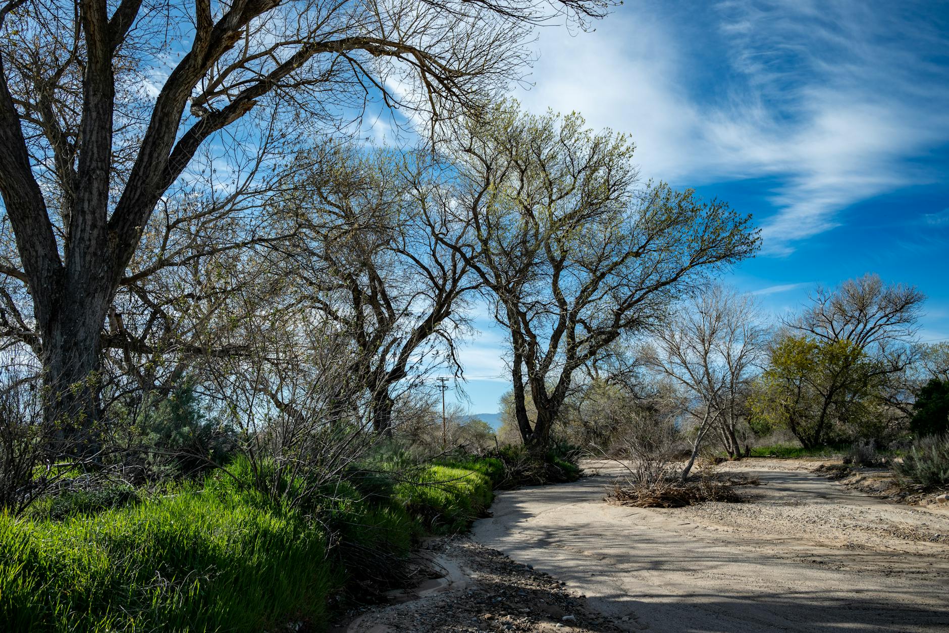
The Ventura River corridor drops over 200 feet in three miles, with grades hitting -6% to -9% at the steepest points near mile 15. Foster Park lines the road with giant California sycamores, some of the better shade you'll find outside of Meiners Oaks, and the gorge narrows as the river drops toward the coast. It is a beautiful and punishing stretch.

Add 10 seconds per mile over goal pace. Shorten your stride. Lean slightly forward and let your cadence absorb the grade rather than braking hard with each step. This is counterintuitive, the road is dropping and you are running slower than goal pace, but destroyed quads at mile 16 produce a very different race from mile 19 onward than intact ones do.

WSW headwind picks up through the corridor as the valley funnels coastal air directly toward you. Add that to the grade and the fatigue and this section asks for more than it looks like on paper.

into the city Miles 16-19
10% shadeCoastal wind-80 ft
Into the City

The terrain eases. Ventura Avenue arrives and the city comes back into view, industrial and commercial buildings, 10% shade, the Pacific a few miles ahead. The headwind from the coast continues.

If the Foster Park descent went well, this section is recovery and rebuild. The grade continues gently downhill and the legs can start to find their rhythm again. Run 5 seconds per mile faster than goal pace through here. Not hero miles, just steady progression toward what the Promenade is about to ask for.

If the descent didn't go well, this is where you find out.

the promenade Miles 19-22
5% shadeCoastal windFlat
The Promenade

Mile 19. The Pacific Ocean appears to your left. The Ventura Promenade, a wide concrete pathway along the beachfront, stretches ahead with the Ventura Pier visible in the distance. The pier is nearly 1,700 feet long, originally built in 1872, still standing over the same ocean it has faced for 150 years.

The crowd is the heaviest it has been since Ojai. After miles of open valley road and exposed corridor, this section delivers genuine energy. It will tempt you to surge.

Don't surge yet. Run 5 seconds per mile faster than goal pace and save the real push for mile 22. The final 4 miles from downtown Ventura to the beach finish should be the fastest of your day. That only works if you haven't spent them early on the Promenade.

the finish Miles 22-26.2
10% shadeVariable wind-20 ft
The Finish

The course moves through downtown Ventura with Mission San Buenaventura, founded in 1782 as the ninth and final California mission established by Father Junípero Serra, visible nearby. Then back to the beachfront for the last mile-plus along San Buenaventura State Beach.

The grade continues its gentle decline toward sea level. The wind at the finish often carries a slight tailwind component as the course alignment shifts. The ocean is in front of you. You started in the mountains before sunrise and you are finishing on a beach in the Southern California morning.

Run the final 5K at 12 seconds per mile faster than goal pace if the race went to plan. If it went very well, faster than that. This is the payoff section and the course makes it available, but only to the runners who protected their quads in the gorge.

get your race partner

You don't need to remember all of this on April 19. We give you a voice in your ear that knows what's coming, including the exact moment at mile 15 when the grade hits -9% and your quads are asking questions, and exactly what to do about it.

This isn't a generic plan. It's built around this course.

Get your race partner

Free · iPhone + Apple Watch

Answered by Us (8 answers)

Mountains 2 Beach vs CIM
Which net-downhill BQ course is right for you?
Is Mountains 2 Beach a good BQ course?
21.6% BQ rate, PR Score 99.93
The Ojai Loop
Why the first 7 miles go uphill
Why flat feels like uphill
The net-downhill pacing trap
The shuttle to Ojai
Logistics for a point-to-point start
The downtown Ventura hill
The miles nobody warns you about
The BQ gong and the beach finish
One of the best finish lines in running
M2B course guide: Ojai to the ocean
Full course walkthrough

final notes

Mountains 2 Beach runs differently from almost every other marathon because the difficulty isn't in the climbing. It's in managing the descent. The course drops 1,252 feet over 26.2 miles and the question isn't whether your legs can handle that. It's whether you let them handle it too fast, too early, in the wrong section.

The gorge miles at Foster Park are where it gets decided. They feel generous because the road is dropping and the sycamores provide shade and the river is somewhere below you. They are not generous. They are the most technically demanding section on the course and the runners who treat them that way arrive at Ventura Avenue with something the other runners don't have.

Keep it controlled through the Ojai foothills, let the Ojai Valley Trail carry you at a sensible pace, and protect your quads in the gorge. Do that and the Promenade feels like what it should feel like: 7 miles from the finish, Pacific Ocean to your left, the mountain you started on somewhere behind you in the distance.

run it with someone who knows the course

You don't need to remember all of this on race day. We give you a voice in your ear that knows what's coming, when the descent wants to take your legs, when to hold back, and when the final miles into the beach are yours to run hard.

Raul's a good fit here. Calm delivery, drops local history, and exactly the voice you want at mile 15 in the gorge when the grade is steep and the temptation is real.

This isn't a generic plan. It's built around this course.

Get your race partner

Free · iPhone + Apple Watch